
One of my favorite pages in this project is Appendix G – Westfall Ancestors in New Amsterdam – 1660.
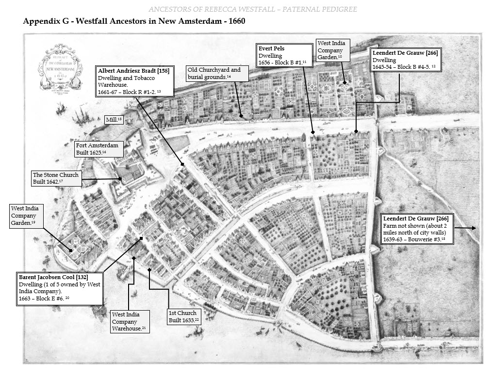
For one thing, I love old maps and I like working them into reports where I can. I also like presenting individual biographical information in a larger context, whether that’s in the context of outside historical events or in timelines or maps that show those individuals in relation to one another.
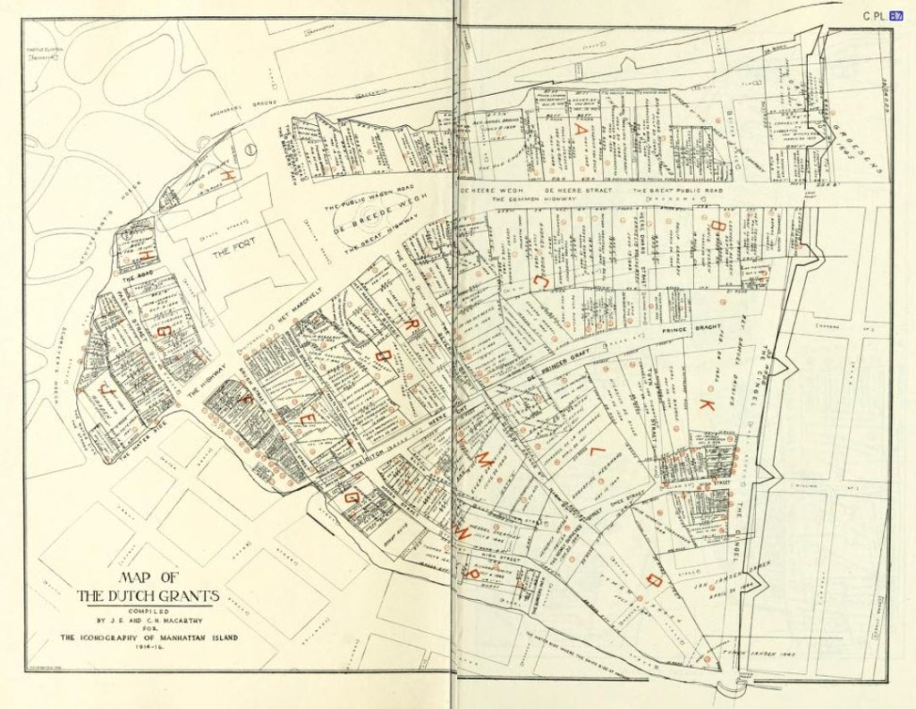
One such opportunity was the residences of certain Westfall ancestors who lived in New Amsterdam at around the same time. I was fortunate to find this Map of The Dutch Grants in I.N. Phelps Stokes’ wonderful book The Iconography of Manhattan Island which includes an analysis of the New Amsterdam deeds of the time and places individual names with all of the lots in the city.
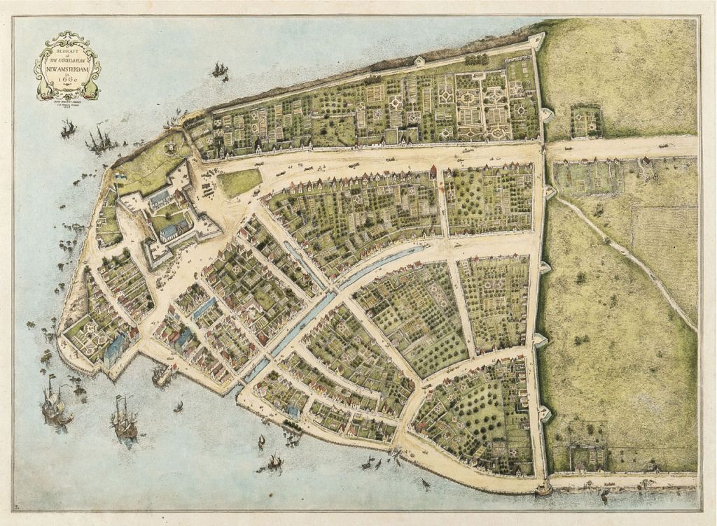
As if that weren’t enough, the map above aligns with another more decorative and famous map titled “Redraft of the Castello Plan New Amsterdam in 1660” which can be accessed at Wikipedia.
Using a grayscale version of this map in PowerPoint, it wasn’t hard to add city landmarks from Wikipedia and Westfall ancestor residences from The Iconography of Manhattan to make an appendix page customized to the aims of the Westfall project.

Leave a comment